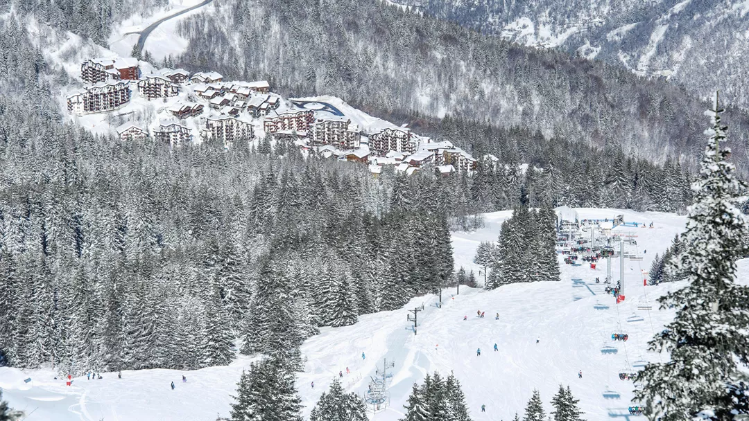
What is the weather like in La Tania in France, and what is the forecast for the next few days? Check the current weather forecast for La Tania on this page. Here, you will find the weather forecast for the next 48 hours as well as the next 14 days, so you’ll know exactly what to expect and what the weather will be like in La Tania during your winter holiday.
The weather in La Tania
On this page, you will find the current weather forecast for La Tania, located in the ski resort of Les Trois Vallées in France. Check the forecast and temperature for both the valley and the mountain. This will help you see what conditions will be like on the slopes and whether you need to add an extra layer for the day’s skiing. Will snow be in the forecast, or will the sun be shining? And what about the wind? How high is the frost line (0-degree limit), and what is the current snow depth in La Tania? Read on for all this information!
Jump directly to:
48-hour weather forecast for La Tania
16 April 2025
Night
Expectation 0 mm
0-degree limit 2698 metres

7°C

Morning
Expectation 3 mm
0-degree limit 2428 metres

7°C

Midday
Expectation 10 mm
0-degree limit 2399 metres

6°C

Evening
Expectation 12 mm
0-degree limit 1715 metres

3°C

17 April 2025
Night
Expectation 20 mm
0-degree limit 1487 metres

1°C

Morning
Expectation 22 mm
0-degree limit 1540 metres

1°C

Midday
Expectation 5 mm
0-degree limit 1731 metres

3°C

Evening
Expectation 1 mm
0-degree limit 1620 metres

2°C

16 April 2025
Night
Expectation 0 mm
0-degree limit 2625 metres

-4°C

Morning
Expectation 3 cm
0-degree limit 2454 metres

-5°C

Midday
Expectation 10 cm
0-degree limit 2162 metres

-4°C

Evening
Expectation 12 cm
0-degree limit 2048 metres

-4°C

17 April 2025
Night
Expectation 20 cm
0-degree limit 1858 metres

-5°C

Morning
Expectation 22 cm
0-degree limit 1874 metres

-5°C

Midday
Expectation 5 cm
0-degree limit 1874 metres

-5°C

Evening
Expectation 1 cm
0-degree limit 1721 metres

-7°C

14-day weather forecast for La Tania
Date
Weather and snow
Expectation
Wind
Frost line
Date
Weather and snow
Expectation
Wind
Frost line


1640 metres
Date
Weather and snow
Expectation
Wind
Frost line


1467 metres
Date
Weather and snow
Expectation
Wind
Frost line


1509 metres
Date
Weather and snow
Expectation
Wind
Frost line


2421 metres
Date
Weather and snow
Expectation
Wind
Frost line


1949 metres
Date
Weather and snow
Expectation
Wind
Frost line


1711 metres
Date
Weather and snow
Expectation
Wind
Frost line


1871 metres
Date
Weather and snow
Expectation
Wind
Frost line


2050 metres
Date
Weather and snow
Expectation
Wind
Frost line


2338 metres
Date
Weather and snow
Expectation
Wind
Frost line


2590 metres
Date
Weather and snow
Expectation
Wind
Frost line


2575 metres
Date
Weather and snow
Expectation
Wind
Frost line


2565 metres
Date
Weather and snow
Expectation
Wind
Frost line


2535 metres
Date
Weather and snow
Expectation
Wind
Frost line


2522 metres
Date
Weather and snow
Expectation
Wind
Frost line


1974 metres
Date
Weather and snow
Expectation
Wind
Frost line


1663 metres
Date
Weather and snow
Expectation
Wind
Frost line


1599 metres
Date
Weather and snow
Expectation
Wind
Frost line


2374 metres
Date
Weather and snow
Expectation
Wind
Frost line


1949 metres
Date
Weather and snow
Expectation
Wind
Frost line


1711 metres
Date
Weather and snow
Expectation
Wind
Frost line


1871 metres
Date
Weather and snow
Expectation
Wind
Frost line


2050 metres
Date
Weather and snow
Expectation
Wind
Frost line


2338 metres
Date
Weather and snow
Expectation
Wind
Frost line


2590 metres
Date
Weather and snow
Expectation
Wind
Frost line


2575 metres
Date
Weather and snow
Expectation
Wind
Frost line


2565 metres
Date
Weather and snow
Expectation
Wind
Frost line


2535 metres
Date
Weather and snow
Expectation
Wind
Frost line


2522 metres
Snow depth in La Tania
Snow is what makes a ski holiday special. Ideally, we wake up every day to Kaiser weather: a layer of fresh snow, bright sunshine, and a clear blue sky. However, icy temperatures and heavy snowfalls are also part of the experience. Or those foggy days when you ski from hut to hut, warming up with a cup of coffee, tea, or hot chocolate. When it comes to winter sports, the weather can be unpredictable, and nothing changes more rapidly than mountain weather. In addition to the forecast for the coming days, the current snow depth is a key part of the weather report in La Tania. How much snow is there on the mountain and in the valley of the Les Trois Vallées ski area? Check the table below to see the current snow depth in La Tania.
Snow depth on the mountain and in the valley
Mountain: 170 cm
Valley: 120 cm
- Snow depth valley 120
- Cross-country ski trails open (km) 0
- Valley descent open Closed
- Hiking trails open (km) 0
Pistes Les Trois Vallées
Set up SnowAlert for La Tania
Explanation of the weather forecast in La Tania
The weather report for La Tania is updated daily and is carefully compiled by meteorologists working with Snowplaza. Curious about the forecast for the next two days? Check out the 48-hour weather forecast, which provides information for the morning, afternoon, evening, and night. The symbols indicate whether snow or rain is expected, whether it will be cloudy, or if the sun will be shining. Click on "village" to see the weather conditions in the valley, and on "mountain" for forecasts at higher altitudes. The zero-degree line indicates the frost line, which changes depending on the temperature. Don't confuse it with the snowline—snow can still fall several hundred meters below the zero-degree line. For a longer-term outlook, check the 14-day weather forecast for La Tania. Keep in mind that weather conditions can change dramatically over two weeks, so be sure to check back daily if you're planning a winter sports trip soon.


