Le Pleynet Piste map
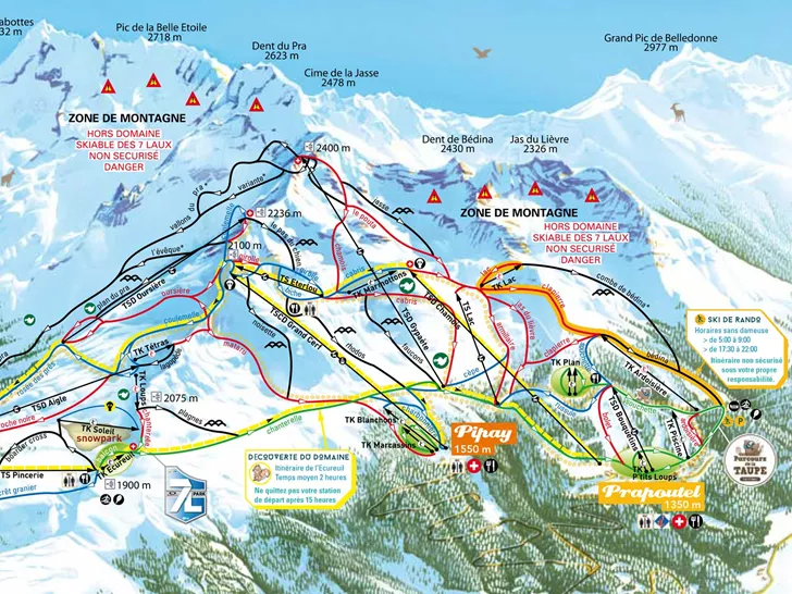
View the current piste map of Le Pleynet below. A piste map always gives a good impression of the ski area, the number and layout of the ski lifts and the ski slopes. The piste map of Le Pleynet in Le Pleynet & Oberstdorf shows access to the ski resort and any connections with other ski areas and ski resorts.
Slopes Map 1 - Les 7 Laux

Slopes Map 1 - Les Sept-Laux
