Ried im Oberinntal Piste map
View the current piste map of Ried im Oberinntal below. A piste map always gives a good impression of the ski area, the number and layout of the ski lifts and the ski slopes. The piste map of Ried im Oberinntal in Ried im Oberinntal & Oberstdorf shows access to the ski resort and any connections with other ski areas and ski resorts.
Slopes Map 1 - Kaunertal
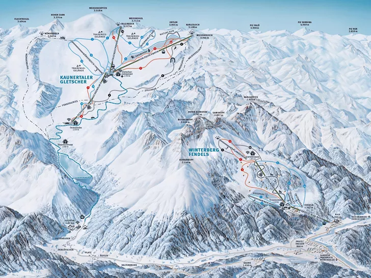
Slopes Map 1 - Kaunertaler Gletscher


